A New Road for Sunderland Point?
1960 - 1980
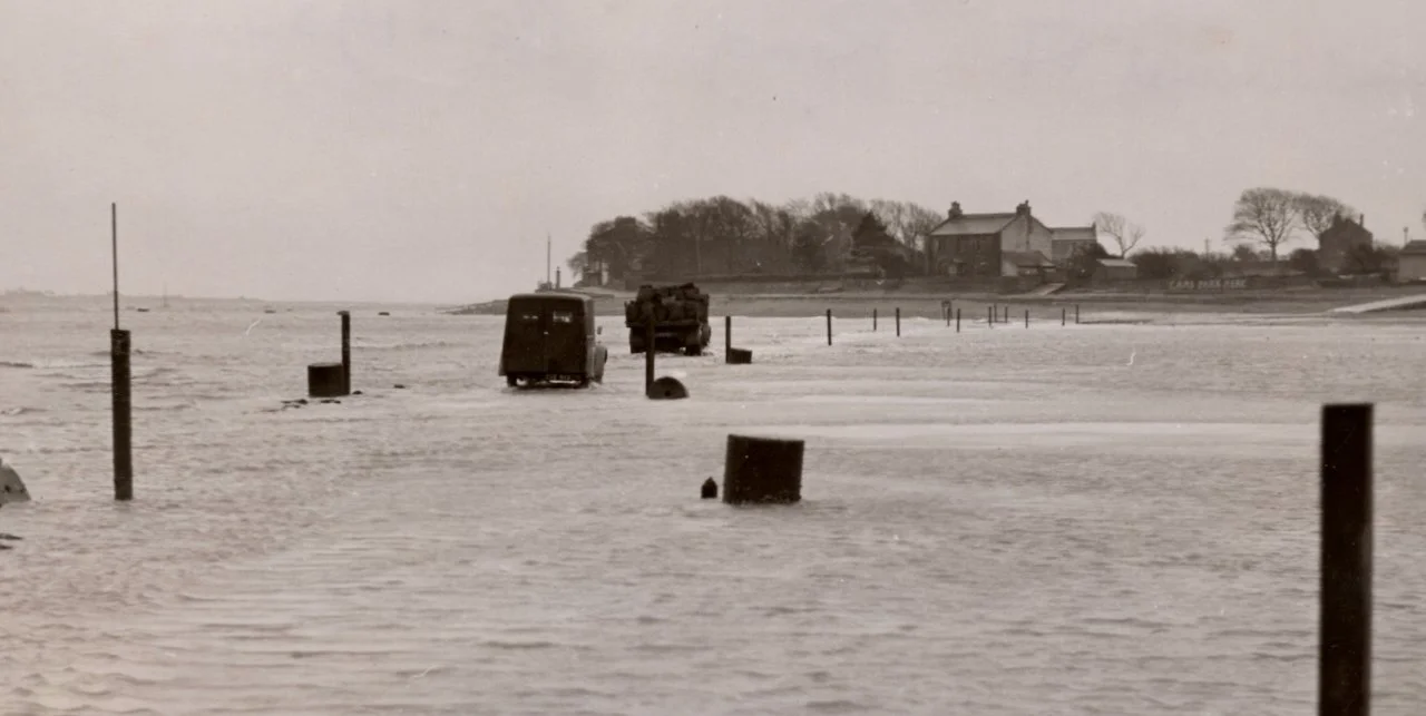
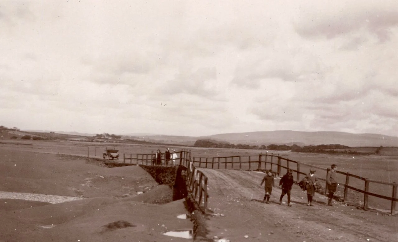
Vehicles crossing the tidal road in the 1950s: Collection Wilton Atkinson
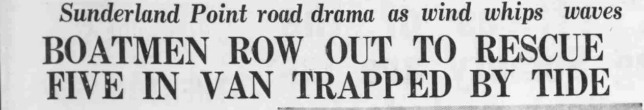
In April 1961, the Morecambe Visitor featured the headline:
‘The fight that began in 1895 is still being carried on.’
Followed by, ‘The road is crumbling, decaying and becoming dangerous. A campaign for a new road has been fought on and off by inhabitants since 1895.’
For years, schemes for a tide-free road had been proposed and dropped due to the high cost and determined opposition. In the early 1960s, a new petition, the latest in many, was submitted, sparking another attempt to build a new road.
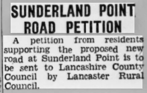
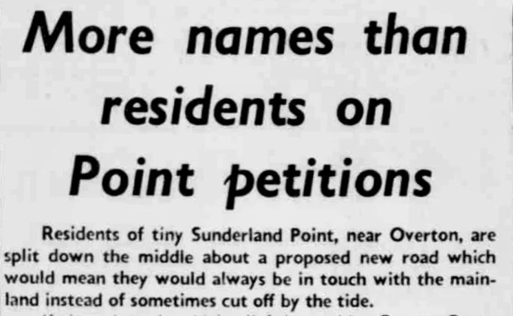
It received considerable support, and in 1964, this appeared in the press.
Lancaster Guardian, November 1964
Two years later, Lancashire County Council announced that it had allocated funds for a new road to Sunderland Point.
This time, it seemed as though it was going to happen.
There were powerful disagreements among villagers, memories of which linger today. We attempt to explain why the road issue was so controversial, why it came to a head and what happened next.
Times had changed – even in the Sunderland Point – something had to be done.
Changes on the Point
By the mid-1960s, the houses used only for holiday visits had reduced in favour of full-time residents. Many worked in nearby towns, and almost everyone had a car.
With work, schools, public services, restaurants, pubs, theatres and cinemas all off the Point, for some, travelling around the tide table had lost any charm. It was a social irritant and a daily chore, especially for those with children.
The Condition of the Road
It had been 30 years since the last significant improvement to the road; it was heavily potholed, with crumbling edges, and the deposition of mud was, in many places, inches thick.
The 1950s road: From the collection of Wilton Atkinson
The Rural District Council acknowledged that the £600 spent on periodic cleaning was of poor value and sometimes even a waste of money. The mud scraped off was left on the roadside and was washed back onto the track within a couple of tides.
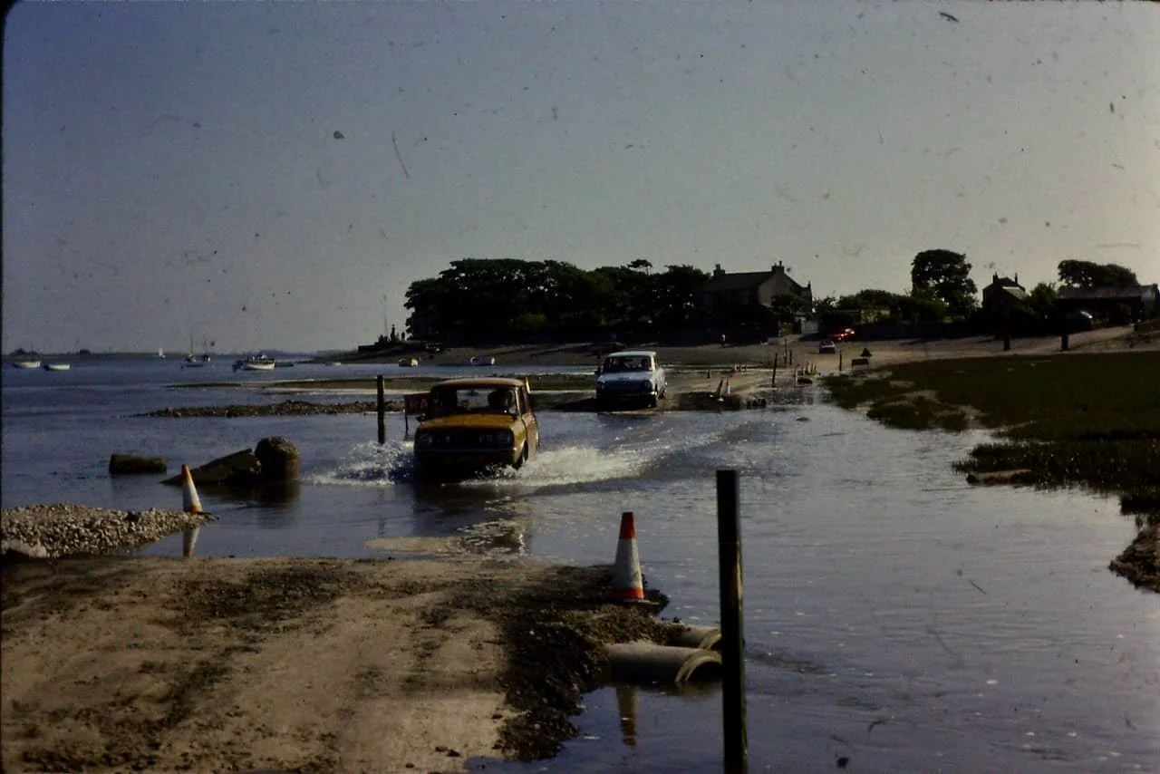
The time the tide was on the road.
The road was covered by nearly every tide. Today, an 8-metre tide may not reach the road; in 1964, it would have meant waiting more than an hour. For the larger tides, the wait could be seven to nine hours.
The Tide on the Road and Prince: A Peter Hall photo
The Schoolchildren
The Point children were at the forefront of road complaints. Even the local education committee formally protested to the County Council about the challenges children face in getting to school on time while staying dry and clean. The school in Overton maintained a supply of clean, dry clothes.
This letter is a good example, written to the Morecambe Visitor in 1965 (edited).
‘(I want to) draw attention once again to the conditions the children of Sunderland Point endure when walking to and from school when the tide has flooded the road.’
Today after leaving school the children arrived home wet, cold and mud spattered having had to walk home in the dark through the fields which after all the rain (was) a mud bath.
They arrived home one and a half hours later, very weary children. The eldest of these is 10 years old. They have to walk alongside deep, unfenced ditches, which in the dark are very dangerous.
It would seem like the old story of a tragedy happening before anything was done about the road.’
Children on the road on a dry Summer day in the 1940s: Collection Wilton Atkinson
In the wider world
By the early 1960s, although Morecambe had begun its rapid decline as a holiday resort, it still attracted large numbers of holidaymakers. The annual ‘switching on’ of the end-of-season illuminations continued to draw thousands of people.

Morecambe in the 1960s during the illuminations: Source Facebook.
While the number of holiday visitors decreased, the town's permanent population had tripled during the century. Morecambe attracted older retirees, often from the mill towns of Yorkshire, who could afford cars and appreciated a day out.
A mile from the Point, in Middleton, Pontin’s Holiday Camp hosted thousands of visitors each year (the dining room had seating for 3,000). Many would visit the Point by car rather than a gentle stroll down the West Shore.
Visitors to the Point
There are no reliable statistics, and visitor numbers are hotly debated. There is an extravagant claim of ‘one thousand’ on a summer bank holiday in the 1930s. On weekends during the summer season, a place to park a car was hard to find.
And there is this.

Lancaster Guardian April 1968: Courtesy Guardian Newspapers
During the public enquiry into a caravan site at nearby Meadow House Farm, it was claimed that visitor numbers had saturated the patience of residents. Getting on and off the Point at weekends was nearly impossible, and a misbehaving minority would violate privacy by entering private gardens and peering through front room windows.
The Village Dilemma
For many villagers, the frustration of a broken, muddy road, the endless waits, difficulties in getting to work, children attending school, limited social life off the Point, and concerns over access to emergency services had reached a breaking point.
However, due to the increase in visitors, the village's privacy and unique quality were in danger of being lost. Who in their right mind would want a new road?
Caught in the tide
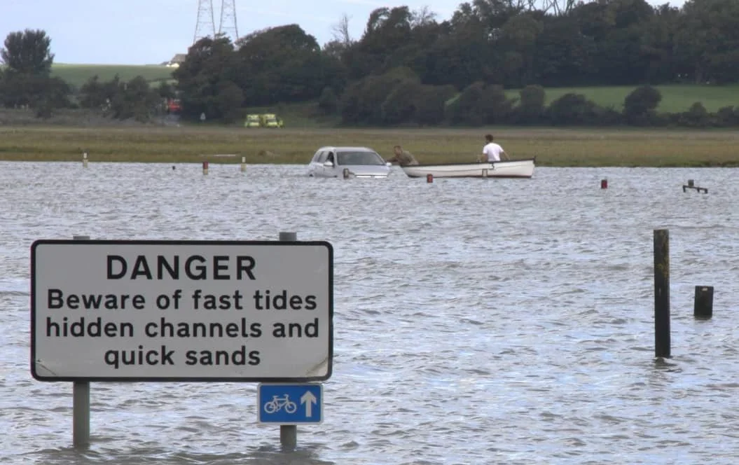
Importantly, the dangers of the road were attracting serious attention in the wider world.
Looking back, it’s difficult to appreciate the considerable number of rescues. In September 1968, after bringing a family with two young children to safety from a near-submerged car, Philip Smith (senior) told the newspaper reporter it was the sixth serious incident that year. Dry clothing changes of all sizes were kept at houses near the end of the road. Tom Smith (senior), hero of many rescues, kept a dinghy on the foreshore ready for use.
No one drowned, but a heartbreaking tragedy was sometimes only minutes away. These extracts give a flavour of what might have been.
David Thistlethwaite, one of the three rescuers pictured after the tide had subsided: Courtesy Guardian newspapers.
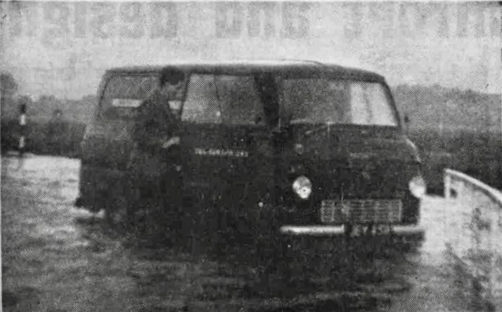
FOUR men and a woman scrambled onto the roof of a van to escape a fast-rising tide which trapped their vehicle on the Overton – Sunderland Point tidal road on Sunday morning. The engine had stalled shortly after, and the van was complexly (sic) covered by the tide.
Lancaster Guardian December 1965: Women struggle in tidal drama. The tide pushed by high winds on Thursday night of last week narrowly missed drowning two women, one aged 70, when the water rose rapidly around their car after it had stalled on the lonely Overton - Sunderland Point Road.
The Visitor, March 1967: HOLIDAYMAKERS RESCUED FROM CAR ROOF IN NICK OF TIME. Two elderly Easter holidaymakers had to climb onto the roof of their car when they were trapped by the tide on the Sunderland Point road on Sunday; they were rescued in the nick of time.
The Visitor September 1967: three holidaymakers, one of them an 84-year-old woman, were rescued by boat after their car was caught in the tide on the Sunderland Point Rd on Monday.
Another rescue: Photo Alan Smith
The campaign for a new road.
1964
The local councils supported the latest petition, but while sympathetic, the Lancashire County Council (LCC) was lukewarm.
Without fully consulting other villagers, a group of residents in favour of a new road visited Lancaster M.P. Humphrey Berkley. Believing this was the village's view, he encouraged the County Council to consider the project seriously.
Without surveying, costing, or proper consultation, the LCC earmarked £35,000 (excluding the land purchase cost) for a new road.
It didn’t go down too well at the Point…
On October 22nd, 1964, this hit the press.

The Lancashire Evening Post October 22, 1964 (from a scrapbook of Harold Gardner’s cuttings): Collection Rosemary Lawn
An urgent, fresh poll of residents had revealed that 96% were against a new road, including some who had signed the 1964 petition in favour.
Resident Margaret Darby said, “What we wanted to do was simply draw attention to the deplorable condition of the road at present, but none of us ever suggested a new road.”
Husband Bernard Darby added, “None of us wants to see any commercialisation of the Point; picture postcards and nettle beer are definitely out.”
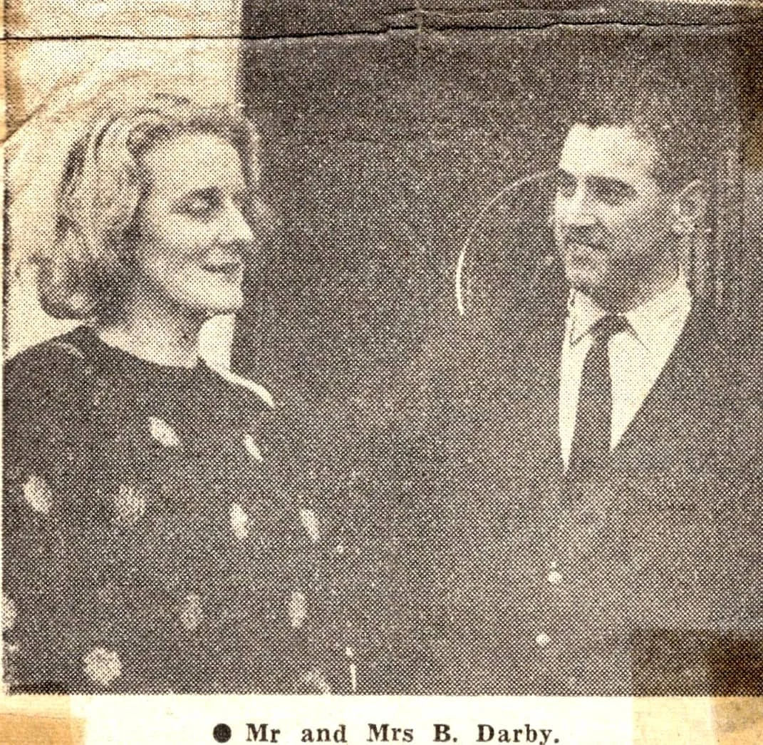
Courtesy Lancashire Evening Post 1964.
But four days later – in a complete and farcical about-face, the Evening Post reported
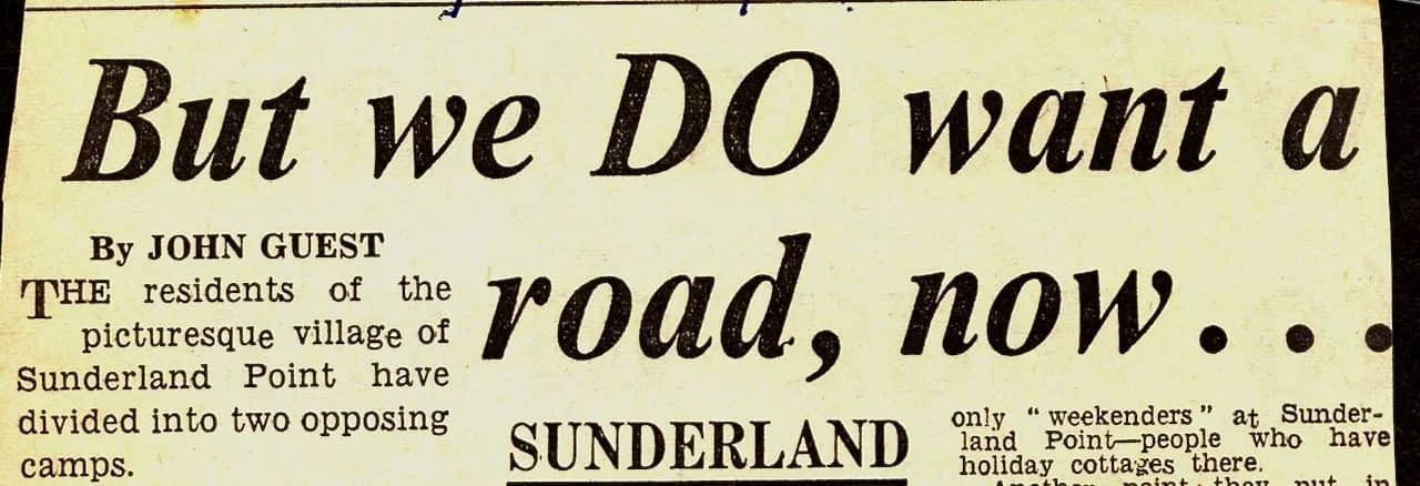
Courtesy the Lancashire Evening Post October 26, 1964
The Post reported that many residents thought that by rejecting a new road, no improvements would be made to the existing road, prompting them to reconsider. As the Post said:
‘The residents have… divided into two opposing camps.’
Despite divided opinion, the Rural District Council (RDC) took a wider view and decided that a tide-free road would be a ‘good opportunity’ for the general neighbourhood. They confirmed support and passed it on to the County Council, recommending action.
For months, the LCC vacillated, and then:
Spring 1968
In April 1968, Mr Thatcher of LCC confirmed, based on the vague 1964 plan, that a new road was scheduled for 1969 and would run down the spine of the promontory.
An urgent letter from opponents was sent to LCC demanding more information.
‘We cannot understand how a major project such as this can be programmed for next year without being as yet routed, surveyed, and costed, and these considerations are not appreciated by the residents, most of whom are very worried by the prospect of this road please do give this matter your urgent attention.’
A soothing letter was quickly sent in reply, saying in council-speak:
‘The position is that loan sanctions for non-principle roads is very limited and the recent financial cuts have had particular impact on road schemes so that a commencement in the programmed year now seems very doubtful. It is undesirable to divert staff from other urgent work to the design of this new road consequently the route has been neither surveyed nor definitely fixed.’
However, excited rumours still circulated, leading to heated letter exchanges, more newspaper articles and demands for meetings with officials
Here is one irritated reply from the Rural District Council:
‘I am also instructed to inform you that they do not consider the tone of your letter to be an appropriate way to write to the chairman and are not prepared to go to Sunderland Point under the circumstances but are prepared to be helpful if properly approached (!).’
June 1969
With the pot still bubbling, the County Council felt under pressure to act and wrote (edited):
We have received letters drawing attention to the difficulties encountered by schoolchildren and to the possible consequences if the presence of the fire or ambulance services were required at Sunderland Point at the time when the existing road was submerged.
We have also been made aware there is an opposing school of thought which maintains that the present access is sufficient and that agitation for an all-weather road is not entirely altruistic or unconnected with the possibilities of development at the Point, which an all-weather road would make possible.
This refers to Councillor Horace Taylor, who owned Meadow House Farm at the time and had made the failed planning application for a Caravan Park the previous year, which was, in part, rejected due to concerns about the tidal road.
After commenting on the various alternative schemes for improving access, it delivered this sensational verdict.
The committee, therefore, decided that it should investigate the possibility of constructing a new road which would follow very approximately the line of the footpath which exists between the road which terminates at Trailholme and the foreshore near Meadow House Farm.
The new road project was gathering pace.
Although there had been no work on any scheme, three had been suggested, as seen on this map,
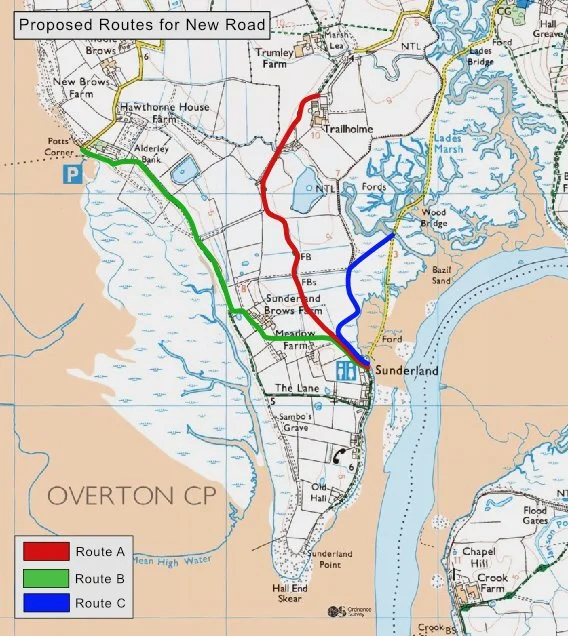
Possible ‘New Road’ Schemes before 1969: Courtesy OS maps, illustration Paul Hatton
The green route, suggested by Horace Taylor, owner of Meadow House Farm, using the track on the West Shore, was never seriously considered.
The blue route, suggested by fishermen, had cost and simplicity advantages but found little favour with officials.
The red route, the land route following the public footpath line, was the considered scheme.
September 1969 - those against
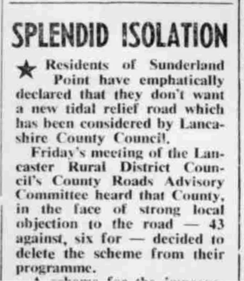
Opponents of the new road approached County Councillor Michael Bates, who advised holding another, but more formal, public poll of residents' opinions.
This was arranged by resident and former City Councillor Alf Morris, with the result.
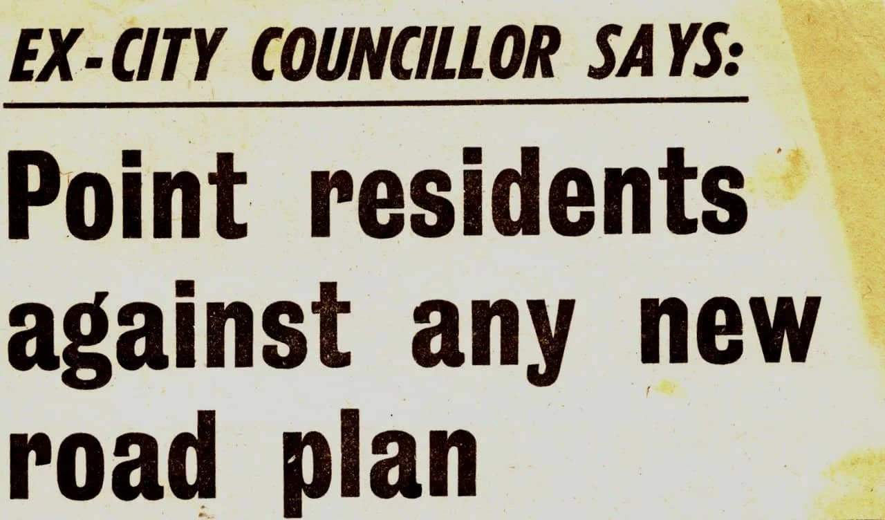
Lancaster Guardian September 1969
The polling results were overwhelmingly against a new road, with 43 votes against and only 6 in favour.
Within weeks, yet another petition was organised by those in favour, which produced – yet again- a split result. The Visitor in October 1969 reported:
The Visitor in October 1969
‘There are just over 50 residents on the point, and 43 signed a petition objecting to the new road. But later, some obviously had changed their minds - because 23 residents signed a petition for the scheme!’
The Visitor carried the comments of Councillor Horace Taylor, who threw petrol on the fires.
"The people who don't want the road are a lot of selfish people," he said. "They are the ones who can sit down all day and take it easy.
"The people against it are the wealthy people. They think they own Sunderland Point. But they don't. They only own a portion of it.”
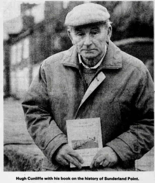
Resident and village historian Hugh Cunliffe sent this amusing letter to the Visitor in October 1969 (edited).
Point teacher hasn't been too late for school
I am a teacher, and I have been a resident at Sunderland Point for about ten years, I have been late for school in Lancaster on two occasions. That's not too naughty! Last year I think about nine days were inconvenient because of having to leave earlier than usual.
‘I do not know whether I'm one of the idle wealthy people mentioned by Coun. Taylor. I own a garage here, which is a converted hen hut, but not the land it stands on. Also, I am pretty idle.
The Visitor in October 1969
The County Council reflected on the evidence. Substantial village opposition was present, and the costs were rising; what had been £33,000 had increased to £40,000 before any land purchase costs were considered.
They said no. The new road plan failed.
Lancaster Guardian December 1969:

And in the Visitor
County drop plan for new road to Sunderland Point
This effectively killed off any new road scheme. But the problem of the road remained.
But something had to be done!
Raising the lowest section of the road at the Point end was the obvious alternative. Still, opponents argued that if the end of the road were raised, there was a danger that the incoming tide would first reach the notorious double dips (between the escape road and the first bridge from SP), so a visitor leaving the Point, thinking the road was clear, could reach the dangerous low spots, find the tide over the road, and be unable to turn back to the Point before the tide covered the first section.
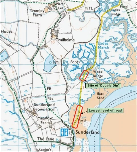
Site of the ‘double dip’ and the lowest section of the road: courtesy Ordnance survey: Illustration Paul Hatton.
Finding a compromise
Step in Norman Shadwell, the Lancaster City Engineer, who worked tirelessly on the project to raise the end of the road by two feet and fill in the double dip.
1975
After six more years of delays, cash shortages and obstruction, Norman and the City Council were ready to act. In October 1975, the Visitor headline read.
‘Top priority for Sunderland Point Road scheme’
In 1976, at the Overton Parish Council's AGM, the chair, now Bernard Darby of Sunderland Point, stated that the Point residents were unanimously in favour of the Shadwell scheme. While not strictly true, the majority certainly were. There was an overwhelming vote in favour of the scheme.
The District Council agreed with the Parish Council ‘that the Sunderland Point Rd should be placed on the Priority List for Improvements, which has already been submitted to the County Council.
A lack of finance led to the project being rolled over to 1977
Brushing aside all further opposition, the County Surveyor stood by Shadwell but said for clarity. ‘Clearly, the raising of the carriageway will enable the road to be used for longer periods between the high tides, but there is no intention of raising the level such that it is clear of all tides.
He instructed Shadwell to include his cost estimates in the budget for the next financial year.
The opponents of the ‘raising of the road’ scheme accepted the inevitable but wrestled with Shadwell over the details.
‘The implications of your proposals will take some time to digest fully, and I hope the work will not be put in hand with undue haste.’
1978
By autumn 1978, Shadwell had resolved the practical issues of the raised road scheme, including how the ‘double dip’ would be filled, what the effect on marsh levels would be, whether large quantities of mud would collect on the shoreside of the raised section, the delays during the works, and how the raised road would be accommodated on the beach.
Finally, in November 1978, Shadwell wrote to those who had reservations with more relief than pleasure
‘I am pleased to note that you do not oppose the scheme.’
The scheme proceeded with the general support of residents and was approved by the County Council.
1979
Work commenced in November 1979.
June 1979, just before the works to the road: A Peter Hall photo.
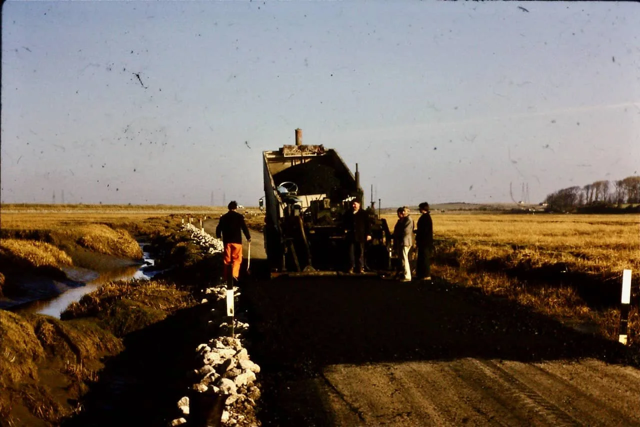
Resurfacing the road, November 1979: A Peter Hall photo.

An 7.9-metre tide during the works on the road November 1979: A Peter Hall photo.
The work was completed in early 1980. It was considered a sensible compromise. The number of people caught by the tide reduced substantially, it was easier to get to and from work, and a taxi service for schoolchildren soon went into daily operation.
And the Point remained untouched – no commercialisation, no mass tourism, and absolutely no nettle beer.
The sources of information for this article include the local newspapers, personal memories and the archived file of papers from the estate agents, Morris and Irvine. Special thanks to Paul Hatton for the illustrations.