Sea Defences
The Sea Defences of Sunderland Point
Defensive measures to protect the land and homes of Sunderland Point from tidal storms have been developed over many generations. Sea walls have been built to strengthen the weakest sections of the Point perimeter. On the shore, stone filled gabions and wooden stakes were positioned to retain solid debris from the eroding land and sea drift stones from the shore to strengthen cliff faces. Monitoring of the land showed these measures had little effect.
Wooden boards and sandbags were in readiness to protect the vulnerable doorways of the lower, sea facing homes but had limited protective value in the face of a violent storm driven flood.
Since the early 2000s there was a growing awareness of an increased frequency and severity of tides. It was believed this was being driven by the erosion to the Point End and the gradual changes in weather patterns.
In 2003 Sunderland Point was classified in the (North West) Shoreline Management Plan (SMP) - a UK wide Government led initiative developing policies for coastal defence over the longer term - as ‘Hold the line’ meaning expenditure would be provided to maintain existing defences.
In 2005 the Shoreline Management Partnership, a civil engineering company, were commissioned by Lancaster City Council to prepare the ‘Sunderland Village Tidal Flood Alleviation’ report which listed in detail and costs the engineered measures to protect homes, property and land surrounding the properties.
In June 2007 a landmark was achieved with the creation of the Sunderland Point Flood Risk Management Partnership Forum with representatives from Lancaster City Council, Lancashire County Council, The Environment Agency, Natural England, Lancashire Wildlife Trust, The RSPB, and the North West Development Agency.
This body was tasked to look not only at risk of flooding to homes and property, but at other flood resilience measures, the erosion at the Point End and emergency access routes into the village.
Simultaneously, Defra (North West) announced flood resilience pilot areas. In their press statement of June 2007, they said ‘30 mainly residential properties at Sunderland Point Morecambe Lancs will receive flood resilience funding at an estimated cost of £110,000, these properties suffer regular and deep flooding, and the local authority will take a leading role in running the pilot scheme’.
In July 2007 the Sunderland Point Community Association (SPCA) was formed with the deliberate and specific aim of uniting the village behind proposals to apply for grants to have these flood defence measures installed. A flood resilience subgroup of the SPCA was established to work on the detail of the grant application.
In August 2007 Defra completed a complex survey of heights above sea level in their ‘Threshold Survey - Flood risk mapping and data management’; expanding the 2005 Lancaster City Council/SMP study.
Later in 2007 a comprehensive application was submitted to Defra for the placement of metal gates at the openings between properties and metal storm boards at homes with doorways at lower doorstep heights – almost all river facing houses. An allowance of up to £5000 on each property was made available to cover all the costs of equipment and installation. This was approved in 2008 and work was completed during that year.
In the subsequent years public policy on shoreline protection has been further developed and in 2012 it was confirmed that Sunderland Point village had been downgraded to ‘No active intervention’ indicating there would be no investment in coastal defences or operations. However the maintenance of private defences would still be permitted.
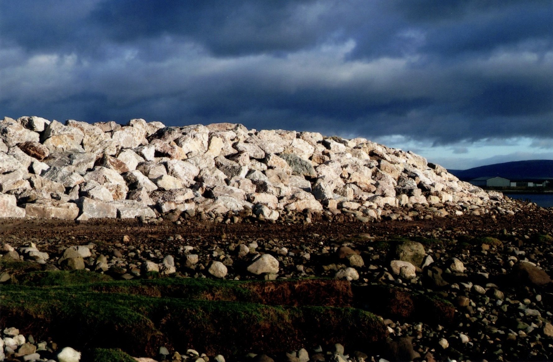
The SPCA’s commitment to protection continues. The Community Association, the Gilchrist family, with the practical help from Sunderland Brows farm, and with some public body funding, has continued to invest considerable sums in significant projects such as the rock armour at the Point End, the embankments, and the new wall on the West Shore, as well as many minor projects including additional defensive gates.
Sunderland Point is defended but the village must now look ahead at the challenges faced by climate change and consider the defences for the future.
Map showing the principle land defences
Selected photographs have been used to illustrate some of the key projects.
All maps have been created by Paul Hatton

Map showing flood defences - with examples of the metal barriers fitted to home front doors.

Not in the exact location - for illustration only
Map showing the metal gates protecting shared entrances to properties or fields

Not in the exact location - for illustration only
Photographs on the maps courtesy of the Gilchrist family, Alan Smith and Bill Morris
Click here to return to the environment home page
Or, to enter the next page ‘Climate Change click here