Flooding
Flooding at Sunderland Point
There have always been storms and serious flooding events along our part of the Lancashire coastline.
William Stout, the Quaker merchant of Lancaster, recorded in his dairies that in October 1720, that ‘ there was a dreadful storm with strong wind from the west and the river was two feet higher that it was ever known. Great damage was done in Lancaster and even more in the countryside and along the coast. Houses and barns were flooded ruining hay and corn. Several people as well cattle and sheep were drowned. But the ships at Sunderland rode it out’.
In the late 19th century damaging storms struck Sunderland Point in the 1870s, November 1881, in September 1890 and in 1898.
In the Lancaster Gazette of the 26th of November 1881 under the heading ‘Damage from the Tides’ it said ‘Severe storm at Sunderland. When the tide was at it’s height, the waves dashed over the Point 25 feet high and the site was one very rarely witnessed. The road between the two Terraces was completely washed away’
From 1900 to the present day the list of years with storm driven tidal floods is long. Those resulting in physical damage occurred in 1907, 1927,1977, 1983, 2005, 2013 and a limited amount in 2020. Others, threatening damage, in 1952, 1990, 1993, 1997 and in 2014.
The worst of these were in 1907, 1927, 1977 and to a lesser extent 2013.
1907
A letter written by Sarah Townley, who was living at number 23, has survived recording an impression of what happened. The letter is hurriedly written and difficult to read. Sarah had been up all night helping with recovery in her own home and assisting neighbours.
In this reconstruction, she says, ‘I am very sorry to tell you that Sunderland has been nearly washed away with the storm last night…I can scarcely describe it, but it has done an awful lot of damage’. She describes walls washed away, cottage front doors broken down, damage to furniture and other household items. Her own house was filled with water and mud, and she has spent ‘nearly all the day’ washing it out.
Further into the letter she describes the green on Second Terrace covered with personal items washed from the houses and says of William Wells the artist (living at Number 13), ‘Mr Wells beautiful pictures floated out and frames broken some of their things were taken into the fields’.
Here are photographs taken at the time.

Front of number 21 after the 1907 storm: Photo courtesy of the Gilchrist family

Looking towards numbers 23, 22 and 21 after the 1907 storm: Photo courtesy of the Gilchrist family

Second Terrace after the 1907 storm: Photo courtesy of the Gilchrist family
1927
The equally terrible flood of 1927 was described by Philip T. Gilchrist in a letter sent to his sister Dora. This long and affectionate letter provides a fascinating and detailed account of the flood and its aftermath. It also provides an insight into the personal experiences of many of the villagers.
We have prepared a Magazine article on this letter and to read this first hand account please click here
1977
A very severe storm hit the coast of the North West England on the 11th of November 1977 causing extensive damage to properties and flood defences. The Lancashire coast was hit hard notably in Morecambe, Blackpool, and in Fleetwood where the storm surge was measure at 1.2 metres, where, sadly, a person was drowned.
In a report complied afterwards by the Environment Agency they said
‘The whole of the coastline was affected by extremely high and rough sea conditions, with a massive surge of water along the coast. High winds generated waves that became increasingly severe. The Institute of Oceanographic Sciences reports the tide levels exceeded the 1 in 100-year tide level, approaching a similar scale of devastation to 1898, 1907 and 1927.
Early on 11 November 1977, the southerly wind over the Irish Sea was Force 8 gusting to Force 10. Throughout the day the wind speed increased, and by 11pm it was at Force 10 gusting to Force 12.
During the night the tide reached a level of 7.3metres above normal. Before this, the previous highest recorded tide was 6.2metres in 1954.’
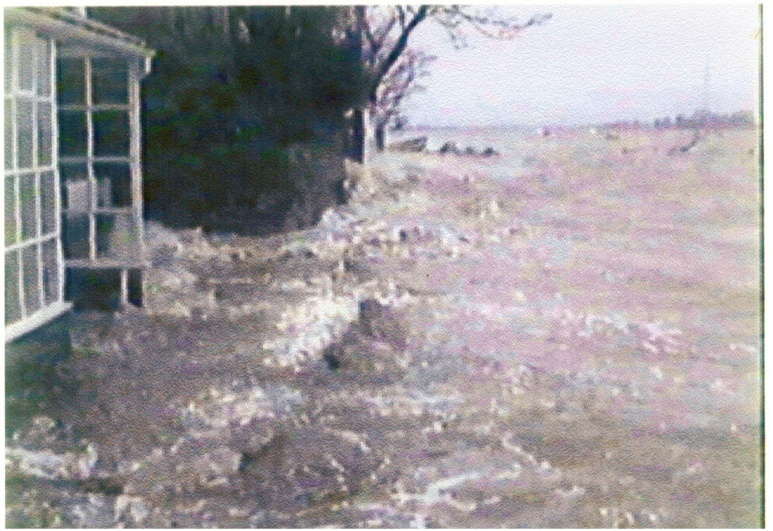
At the Point, it was a frightening experience. Sea water broke down defences and filled homes with mud and stones. Walls towards the Point End were washed away. These photographs were taken during an early period of the storm before it reached its full force.

Waves over First Terrace number 7 to the right: From the collection of Ken Calverley

Waves rolling into numbers 4, 5 and 6: From the collection of Dorothy Calverley
Waves into the porch of number 4 and up to the walls of number 3: From the collection of Dorothy Calverley.

Another wave at the wall of Number 3: From the collection of Dorothy Calverley.
This photograph was taken shortly after the storm

The wall past number 20 heading towards 21, washed away and the stones in the field: From the collection of Ken Calverley.
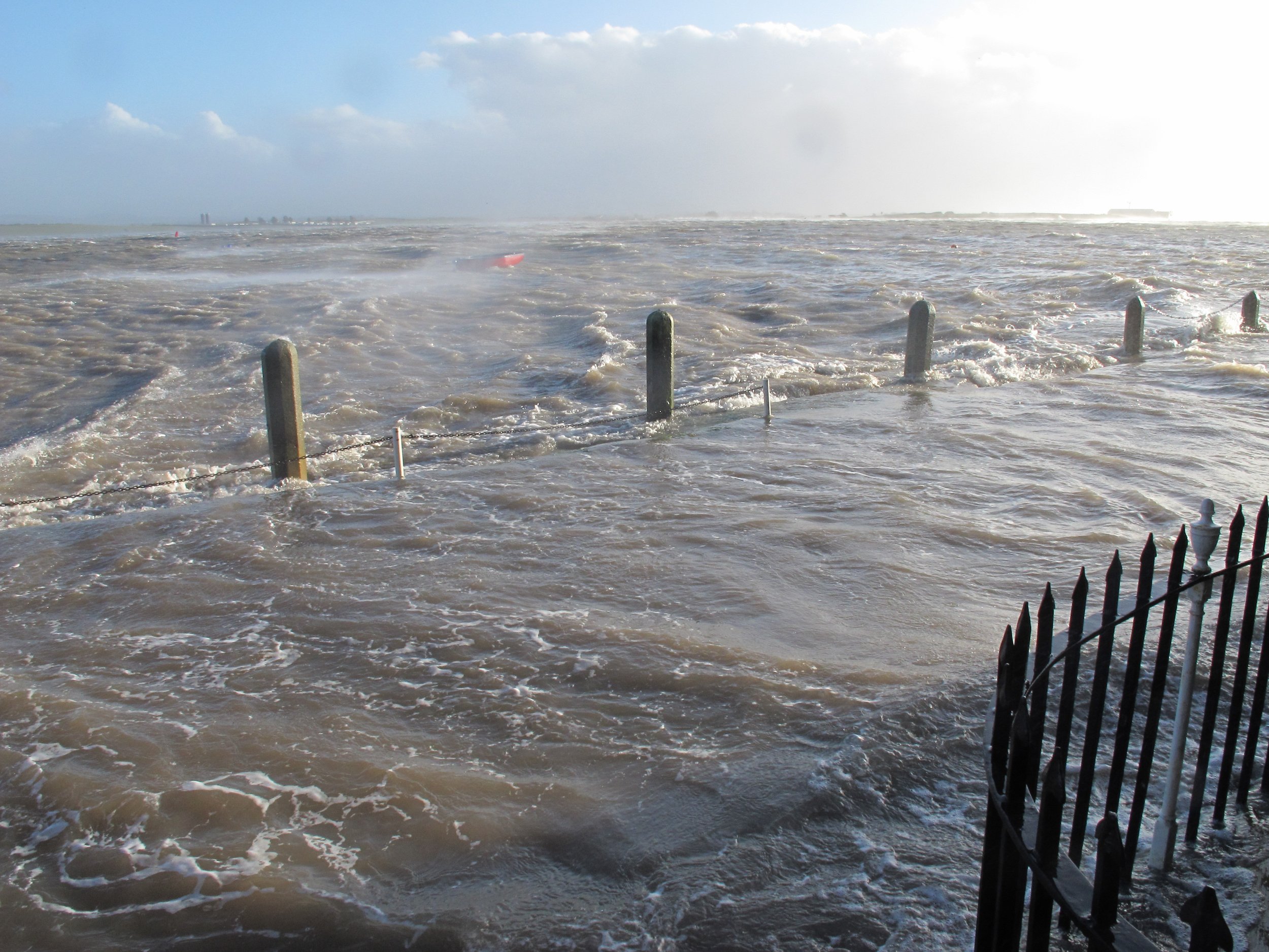
2013
These photographs capture the flood tide of December 5th 2013. In this event there was a storm surge of 1.25 metres – giving a chart height of over 11 metres. Flood defences had significantly improved by this time and damage was minimal. However, the violence and threat of the tide is clearly visible.

Waves at the front of number 7: From the collection of Alan Smith

A strong wave and water on the green in front of numbers 22 and 23: From the collection of Alan Smith.

The storm in full spate at number 21: From the collection of Dom Green.
2020
The most recent storm where the sea came onto the Terraces.

First Terrace: From the collection of Alan Smith
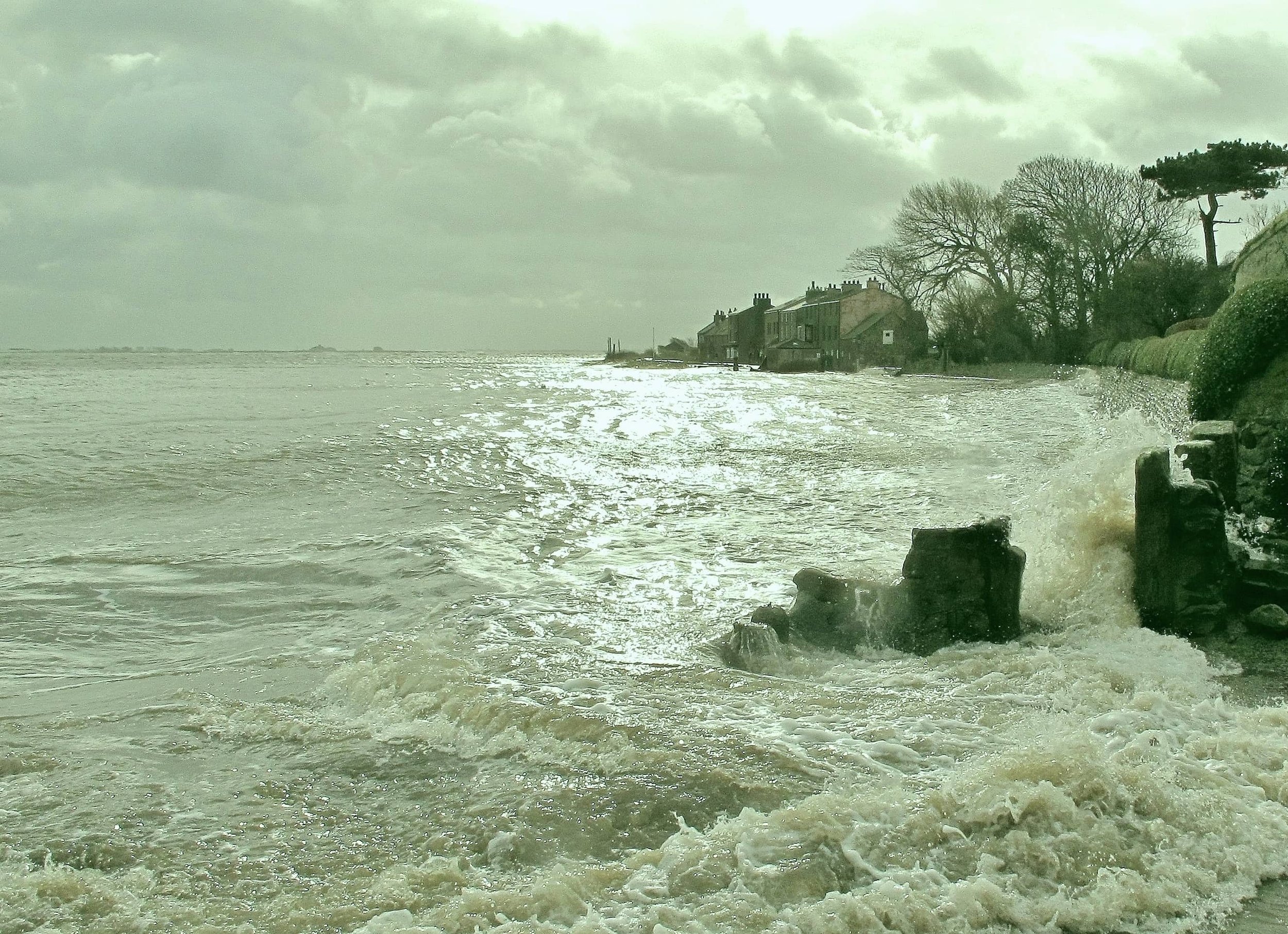
The Pad and Second Terrace: From the collection of Alan Smith
Click button to return to the environment home page
Or, to enter the next page ‘Erosion’ click here