Erosion

Erosion – The Point of Sunderland
Image courtesy of Dom Green
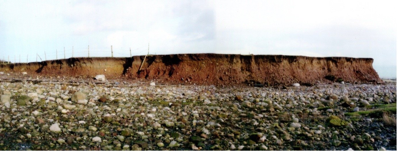
What a great photograph. This is the tip of Sunderland Point taken before the extensive flood defence work was carried out which placed rock armour – great boulders of rocks – around the Point End to protect the cliff face from the progressive erosion which had washed away a substantial amount of the land.
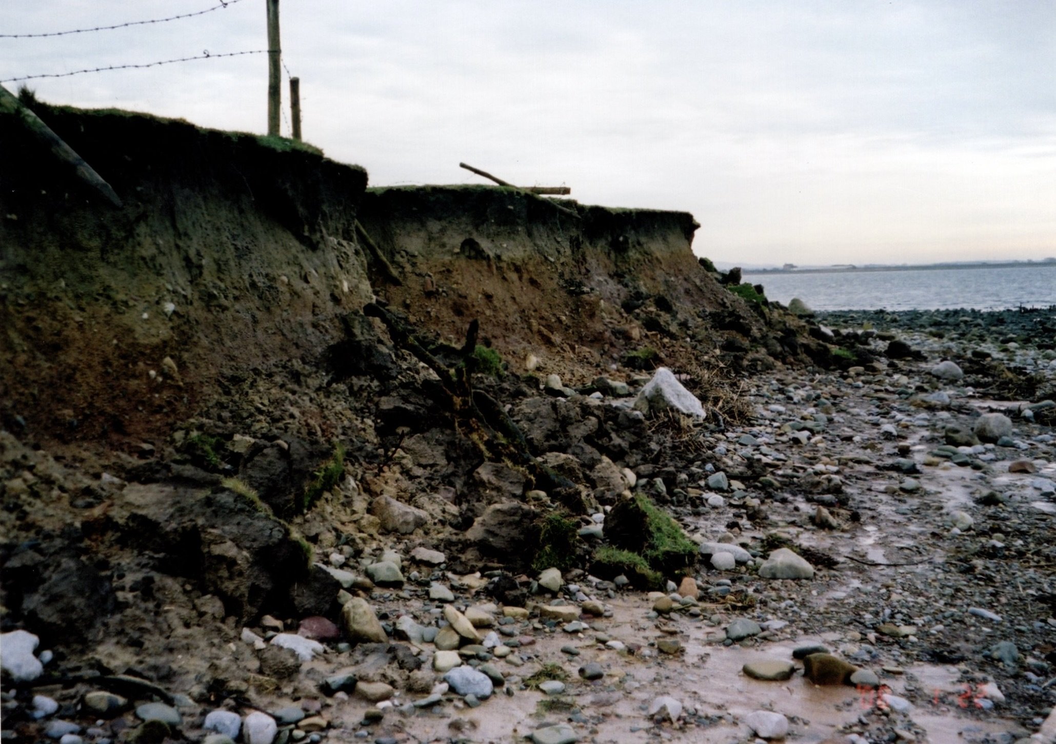
The Point end before the rock armour: Image courtesy of the Gilchrist family
Fieldwork in 2011, supported by an examination of historic maps since 1844, confirmed that considerable cliff retreat had occurred during the previous 167 years. Calculations made at the time suggested a land area loss of 7,350 square metres during this period. A retreat of the Point End by some 75 metres.
A survey of the stones on the beach suggested the Point End was at least 100 metres (almost the length of the average soccer pitch) further south in the early days of the village.
Opinion from long-time residents was that due to the erosion of the Point, wave height and energy had increased during storms experienced in the village. This removal of essential protection to the village added urgency to the project.

Image by Paul Hatton
Most of the land at the Point underneath the topsoil is a loose mixture of unconsolidated poorly sorted glacial stones and clay. At the exposed Point, the action of the sea especially during higher spring tides, and when pushed by strong westerly winds, created a retreating cliff face some three metres in height.
The energy from the wave action continuously undermined the subsoil leading to the intermittent slumping and collapse of the cliff face.
The slumping and collapse of the cliff face at the Point End

Image courtesy of the Gilchrist family
An energy filled high spring tide breaking onto the cliff.

Image courtesy of the Gilchrist family
The mud spoil from the cliffs is colouring the sea water. The more powerful winter tides had greater damaging effect than those of summer.

Image courtesy of the Gilchrist family
The major driver of cliff retreat has been the action of the sea, both the seepage of water into the tills that make up the land structure and wave action.

Image courtesy of the Gilchrist family
However, the action of heavy rainfall and winter frosts have also been significant in reducing the compressive strength of the cliff. The already weak geological structure of subsurface loses some of its natural cohesion and becomes more prone to the effects of wave action either wave breaking, or the resulting turbulence afterwards.
The loss of land surface had long been recognised as a major issue and various schemes had been undertaken with some but insufficient beneficial effect. During the last 100 years, as well as stone filled gabions, wooden stakes driven into the foreshore had been extensively used to retain the debris from the cliff and build up the shore.

Image courtesy of the Gilchrist family
The Rock Armour
As Sunderland Point is a conservation area and has a highly protected status for its natural environment, achieving permission for the installation of the highly visible rock armour was problematic. After several years of application and consultation - which began in 1996 - approval was granted in 2013 and work began.

The Point End became a construction site.
Image courtesy of the Gilchrist family

In total some 4000 tonnes of hard carboniferous limestone quarried from nearby Carnforth was placed covering a length of 250 metres of the exposed cliff face. The limestone boulders are placed over a geotextile layer and reach a height of 8 metres above ordnance datum (AOD).
Image courtesy of the Gilchrist family
The rocks have been transported in two hundred, 20 tonne loads from the quarry to Sunderland Brows farm. They were then brought to the cliff face by tractor and trailer in 15 tonne loads – perhaps 270 journeys from the farm to the Point End.

Image courtesy of the Gilchrist family
After delivery, the rocks each weighing between one and two tonnes were manoeuvred into place and laid with careful precision to achieve a robust slope of 1 in 3.
The works were concluded within the planned 5 weeks, successfully overcoming potential delays from the weather and tides. The completion date was September 2013

Image courtesy of the Gilchrist family
The finished rock armour facing another powerful high tide.

As well as providing a covering for the exposed cliffs, the energy in the wave action is dissipated by the rock armour.
Image courtesy of the Gilchrist family
Today, 10 years after completion, while the action of rain and frost continues, the rock armour stands firm and tidal erosion has been halted.

Image courtesy of the Gilchrist family
Click here to return to environment home page
Or, to enter the next page ‘Sea defences’ click here