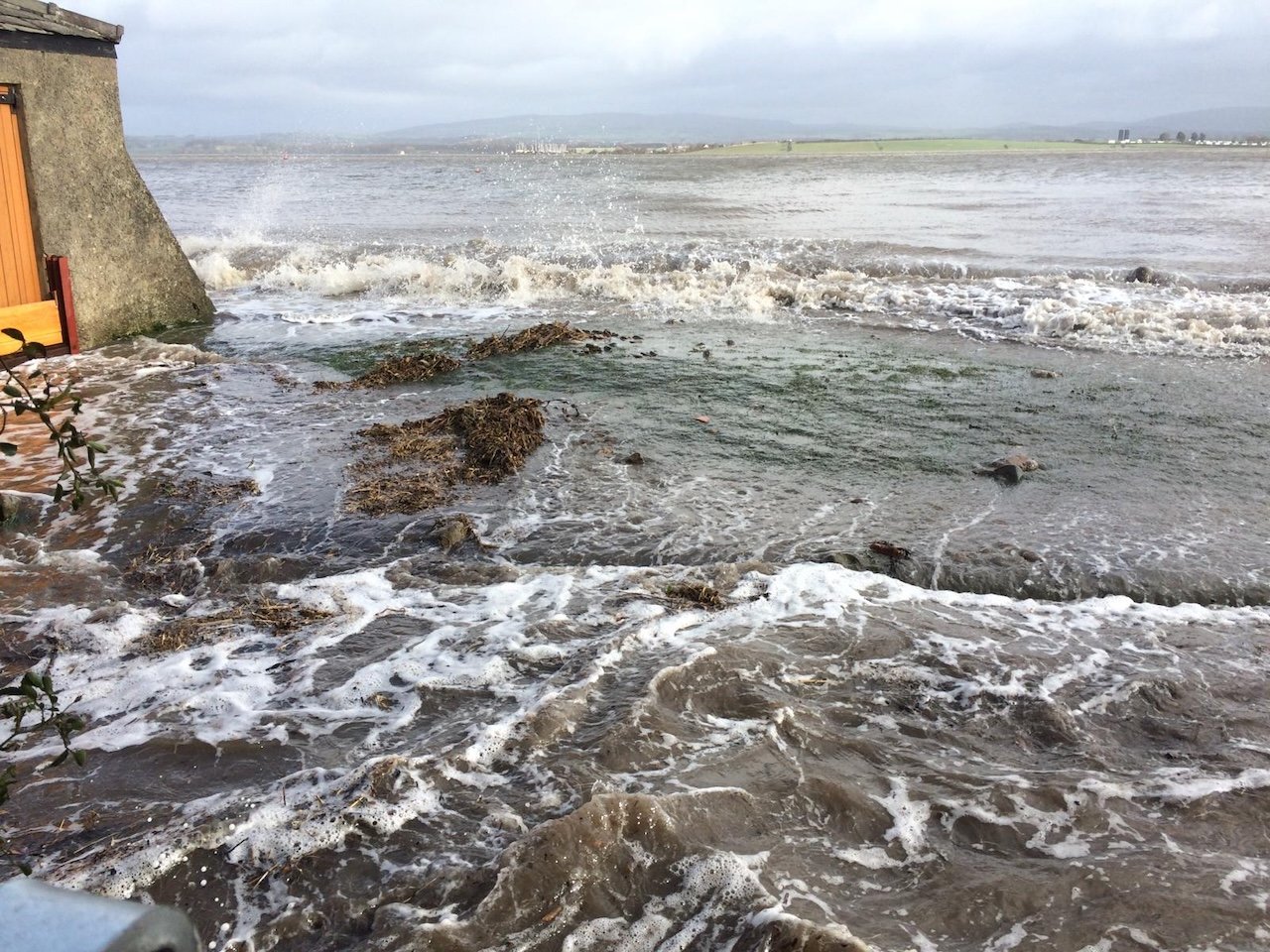
High Tide April 9th, 2024.
High tide April 9th, 2024, Second Terrace: Credit Jo Young
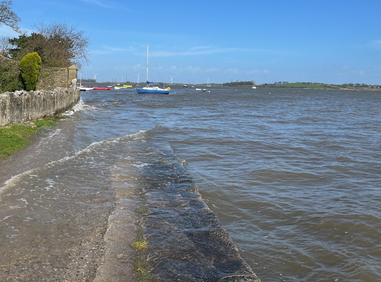
Just after midday on April 9, a higher-than-expected tide sent residents hurrying to fix storm boards as waves spilled on to the Terraces. This video of sea water rising on Second Terrace - kindly shared by Jo Young - provides a vivid and timely reminder of the serious risk of flooding at Sunderland Point.
Predicted to peak at 10.4 metres (above chart depth at Heysham), it became - with the help of a strong wind - a ‘big tide’ for the Point.
It could have been much worse. Had the North-westerly wind been a stronger gale from the Southwest, and had the barometric pressure fallen lower (at c1008 hPa it was not far below the average 1013 hPa) it might have been a very serious flood.
But this was not an unusual tide.
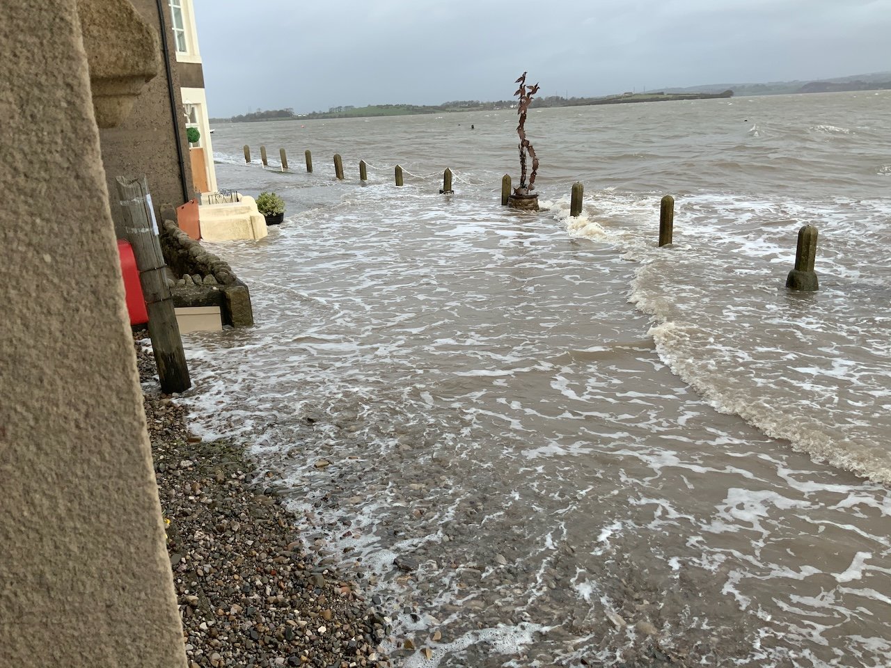
In their analysis of flood risk at Sunderland Point the Environment Agency (EA) estimate that tides reaching the flood defences of the lower lying homes could be as frequent as every other year.
This is consistent with our experience in recent years. During the winter and spring months there will be a ‘big tide’ threatening or testing the flood defences every other year or so.
These photographs provide the evidence.

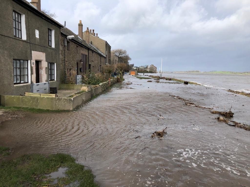
The tide on First Terrace April 2024
On First Terrace in front of number 3, March 2023
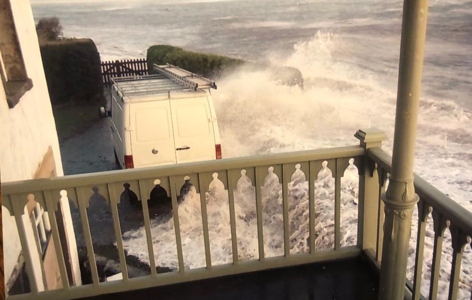
The tide on Second Terrace in March 2020: Courtesy the Gilchrist family
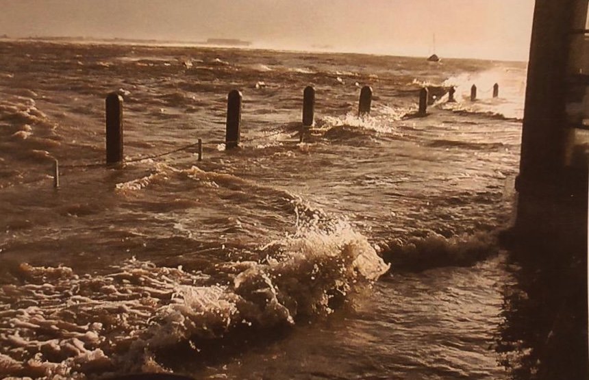
The tide on First Terrace in March 2020

The tide advancing to Second Terrace, January 2018: Photo Lynne Levey
Less frequently, when the winds climb to storm force and the barometer begins to plummet a naturally high tide can become a dangerous and frightening event. This is illustrated by these two remarkable photographs taken in 2013.
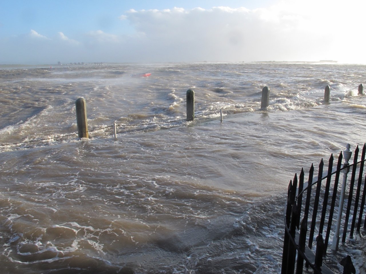
First Terrace in December 2013: Photo Alan Smith
The Old Hall December 2013: Photo Dom Green
The EA calculates the risk of a dangerous 2013 flood will occur less frequently, perhaps a 10% chance each year.
Rarer still are the violent storms which have caused considerable damage, killed livestock, as well as given fright and hardship to residents. These photographs are from the major storm of 1977 taken before it reached full force when it broke down flood defences, front doors and entered houses. (Click here to see our article on the 1977 flood)
Storm of 1977 First Terrace: Collection of Ken Calverley

Blurred photo of waves beginning to reach the houses: Collection Dorothy Calverley.
Destructive storm driven floods also occurred in 1927 and 1907.
(Click here to read a detailed and moving eye-witness account of the 1927 flood)
But sea levels are rising. This has been gradual but will accelerate in coming decades as the full impact of climate change takes effect.
(I have no doubts that tides reaching doorsteps on the Terraces is more usual today than it was 50 years ago.)
A look into the future
In their analysis of future risk, the EA firstly considered the key factors that lead to a dangerous flood.
- The natural predicted height of the tide.
- The strength and direction of the wind.
- The barometric pressure, the lower the pressure the higher the tide. (A difference from the average {1013 hPa} of 1 hPa can cause a difference in height of 1 centimetre.)
Next, this was overlaid with climate change driven rising sea levels.
The Government guidelines used to inform policy predict an overall increase of 970mm (almost 1 metre) to the average height of tides in Morecambe Bay by the early years of the next millennium.
This map is our simplification of their information and shows what would be a rare event – a 0.5% chance, or once in 200 years – of an extreme flood at Sunderland Point. Only the houses higher up the Lane and the Mission Church remain untouched.
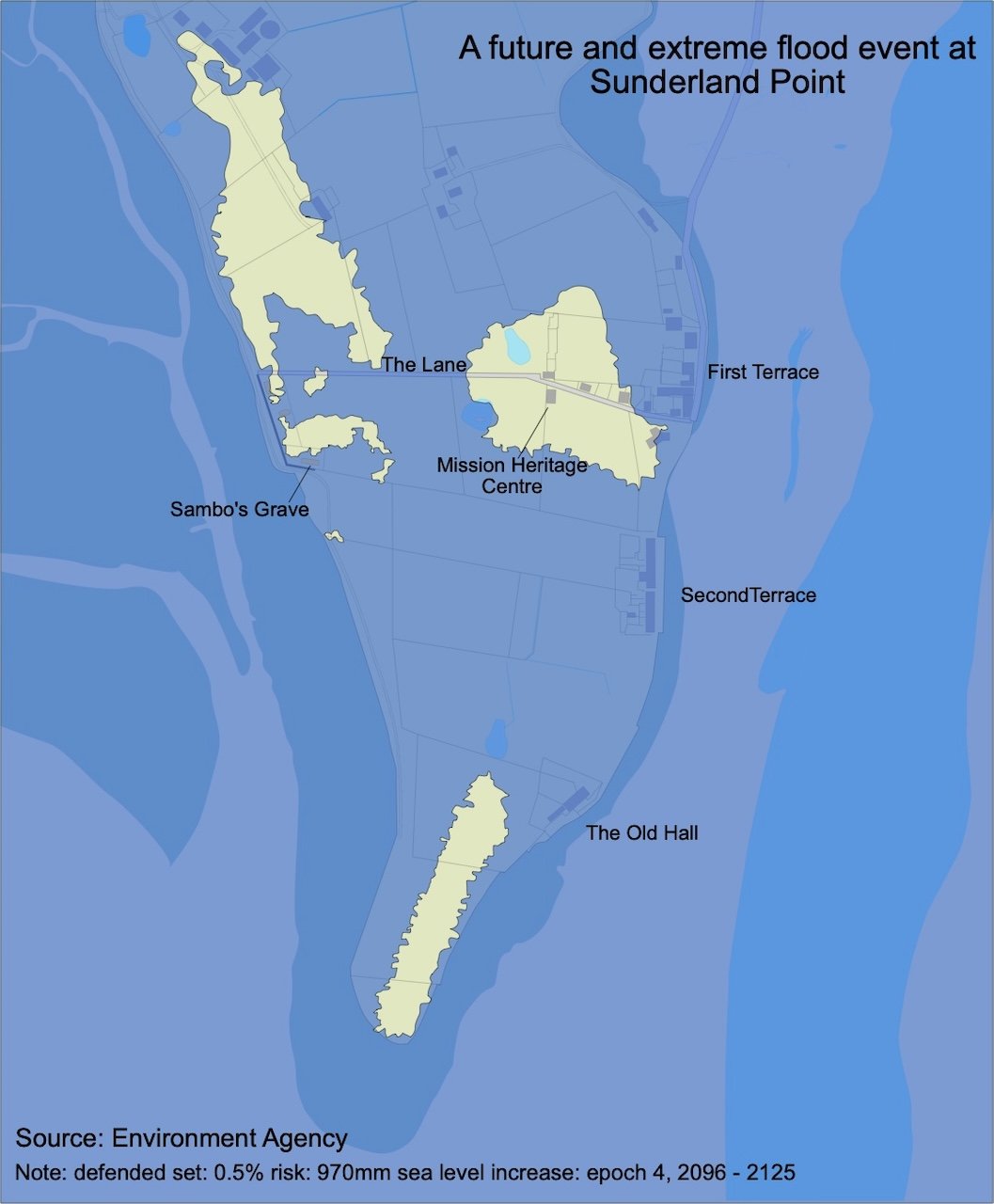
Image created from EA data by Paul Hatton
This is an unlikely ‘worst case’. But it can be appreciated that more likely flooding events could still have devastating effects if not as catastrophic as in this extreme scenario.
The village currently has adequate, proven flood defences at our homes and on the land. For future storms their effectiveness is much less certain.
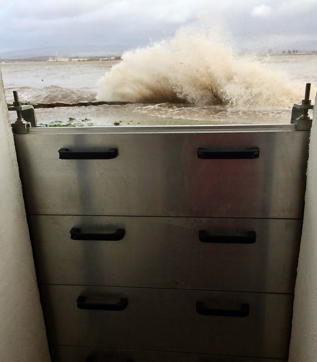
Behind storm boards, March 2020: Photo Jo Young
Between a rock and hard place
The Environment Agency risk analysis confirms the current ‘big tides’ occurring every other year or so would in future take place several times each year. The bigger more threatening tides testing the resilience of current flood defences would take place every other year.
A truly devastating flood might still be rare - but much more likely than today.
Most of the Point Shoreline is described in current government coastal protection policy as ‘No active intervention’, which is likely to prevent the approval of investment using public funds in large-scale schemes that give widespread protection to homes and farmland.
In the future, this may mean a managed evacuation of this historic, beautiful, and remarkable place.
The Community Association, highly successful in the past in securing funding for flood defences, continues to have good links with the Environment Agency, Lancaster City Council, and the Environment Centre at Lancaster University.
We are up to date on flood risk information, have developed new contacts and are investigating alternative technologies. We know Government policy is under review and will continue to push strongly for full support to the village, and with all the villagers.
Many thanks to Jo Young for the video, Paul Hatton for the map, and to Scottie Wilson for editing and advice. Special thanks also to the Environment Agency for much information and guidance.
If you have any questions, please send to editor@sunerlandpoint.net and I will do my best to answer.
Two add-on photos which did not quite fit the text but strongly fit the subject.
The tide on Second Terrace, March 2020: Photo Jo Young
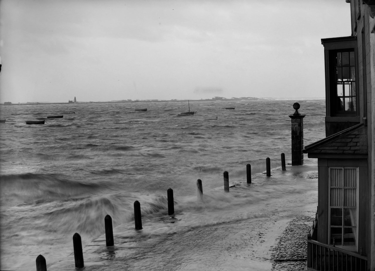
The tide of First Terrace, taken by John Walker from his bay window at number 7 c1900: Courtesy Lancaster City Museums.